News
Hip music scene, great source of international eats, and supposedly the only community in the U.S. named after an artist? From stockyards to railroads, Allston has seen a lot of change from a thriving area for indigenous peoples long before the first Europeans arrived to its current standing as an artsy Boston neighborhood.
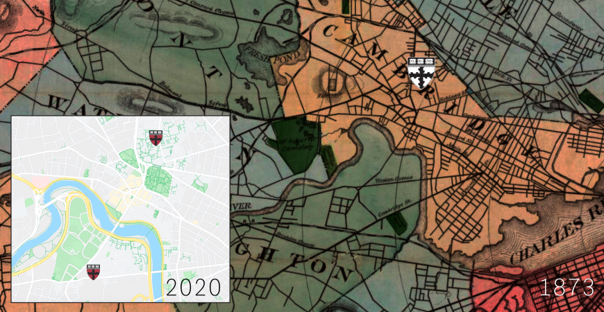
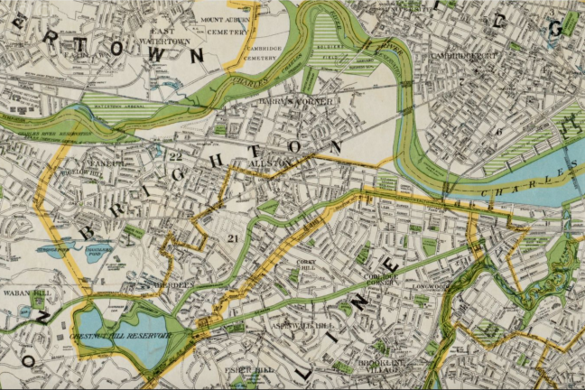
The Cambridge/Allston area in 1873 and 2020. The black and white shield indicates the location of the Lawrence Scientific School, and the color shields pinpoint both current SEAS campuses. (Credits: Google Maps and the Norman B. Leventhal Map & Education Center at the Boston Public Library)
The lands in and around present-day Boston were inhabited by Massachusett people for millennia. In the 1600s, European trading ships traveled through New England exchanging goods with indigenous tribes, and steadily began settling in the area. As early as 1646, Reverend John Eliot, a Puritan missionary known as the “Apostle to the Indians,” sought to convert local Native Americans to Christianity. He founded the “Praying Indian” village – Nonantum – in what is now Newton, and preached his first sermon to the indigenous population in the Massachusett language.
Around the same time, the education of Native Americans was woven into Harvard’s history. The Charter of 1650, by which Harvard University continues to be governed, pledged the College to “the education of English and Indian youth.” Caleb Cheeshahteaumuck of the Wampanoag Tribe, Class of 1665, was the first Native American to graduate from Harvard. From 1655 to 1698, the "Indian College" stood in Harvard Yard, on the site currently occupied by Matthews Hall.
Formerly known as “Little Cambridge,” Allston has had close ties to the original home of Harvard since the College’s founding in 1636. Allston and the adjacent community of Brighton were part of Cambridge for their first 160 years. The first permanent residents of Little Cambridge crossed the Charles River from the Cambridge side.
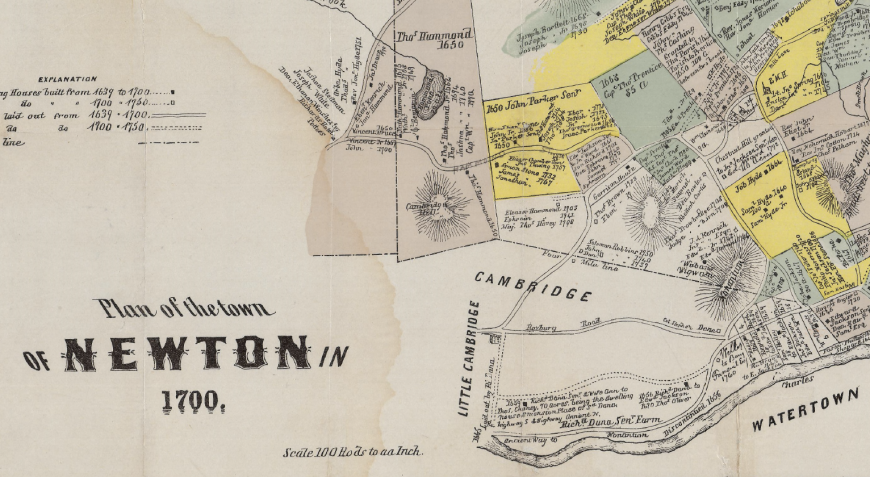
A map of Newton in 1700, featuring Cambridge and Little Cambridge. (Credit: Newton, Mass. government website)
Little Cambridge grew into a prosperous, farming community in the years leading up to the American Revolutionary War. It was home to famous Bostonians such as merchants Charles Apthorp and Benjamin Faneuil. Another native of Little Cambridge, Colonel Thomas Gardner, was an important Revolutionary War figure who was killed at the Battle of Bunker Hill. Several locations bear his name today, including Gardner Street in Allston and the Gardner Pilot Academy, as well as the city of Gardner, Mass.
In 1775, John Winship and his son, also named John, established a cattle market in Little Cambridge to supply the Continental Army, then headquartered in Harvard Square. This enterprise grew rapidly during and after the war, cementing the Winships’ place as the biggest Massachusetts meatpackers by 1790.
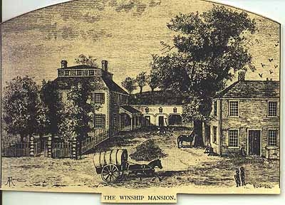
The Winship family mansion (Credit: Brighton-Allston Historical Society)
Up to that point, the only connection between Little Cambridge and Harvard Square was the Great Bridge over the Charles River. When Cambridge’s town government failed to repair the bridge, placing the local cattle industry in jeopardy, the residents of Little Cambridge voted to secede. They won legislative approval of separation in 1807 and chose the new town name Brighton.
In 1915, the Anderson Memorial Bridge replaced the Great Bridge. The new span was named by American diplomat Larz Anderson as a tribute to his father, Nicholas Longworth Anderson, a U.S. Army officer in the Civil War. Both father and son were Harvard College graduates.
Brighton became a commercial hub for agriculture and the cattle trade during the 19th century. By 1866, the town was home to 41 slaughterhouses. A new depot for the Boston and Albany Railroad was built in the area. When slaughtering activities in town were consolidated into one facility and the Brighton Stockyards moved, a lot of land freed up to create more suburban neighborhoods. Cambridge Street was specifically built for better access to the town’s cattle market, nurseries, and other main businesses.
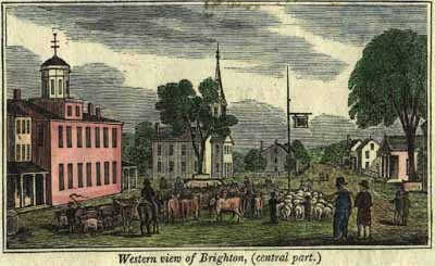
Washington St. in Brighton Center in 1832 with the original Cattle Fair Hotel on the left, the 1808 First Parish Church in the center, and Washington St. on the right in front of the church. (Credit: Brighton-Allston Historical Society)
Brighton was annexed by the city of Boston in 1874, fostering growth and introducing streetcars to the neighborhood. The local population and residential development boomed over the next few decades. All livestock operations ceased by the mid-20th century. The rail yard continued to be used until 2013, and it still can be seen in Lower Allston today.
In 1868, a new post office and train station on the eastern side of Brighton were given the name “Allston,” after the painter Washington Allston. Some accounts suggest has it that the neighborhood was named specifically for his painting, “The Fields West of Boston.” Allston, a Harvard alumnus, is known as America’s first Romantic painter.
The Allston-Brighton neighborhood in 1890. (Map reproduction courtesy of the Norman B. Leventhal Map & Education Center at the Boston Public Library)
The Allston-Brighton neighborhood in 1927. (Map reproduction courtesy of the Norman B. Leventhal Map & Education Center at the Boston Public Library)
Since then, the eastern area of Brighton coinciding with the 02134 zip code has been known as Allston. An officially recognized neighborhood within the City of Boston, Allston is often coupled with the adjacent western Brighton neighborhood and referred to as Allston-Brighton.
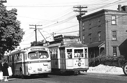
Western Ave. near North Harvard Street circa 1950s. (Credit: Brighton Allston Historical Society)
Now a growing commercial and residential area, Allston is also home to the block-long Science & Engineering Complex (SEC) at 150 Western Ave. Featuring a soaring eight-story atrium and futuristic thermal-efficient skin, along with a makerspace, sustainable labs, state-of-the-art classrooms, and welcoming community spaces, the SEC brings innovation and new development to the neighborhood. Allston continues to be home to many creatives and students, and will soon be making waves for new STEM ventures.
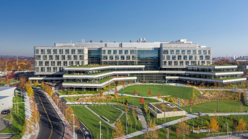
The new Science and Engineering Complex (SEC) in Allston is home to the second SEAS campus. (Credit: Brad Feinknopf)
Topics: Allston Campus
Cutting-edge science delivered direct to your inbox.
Join the Harvard SEAS mailing list.