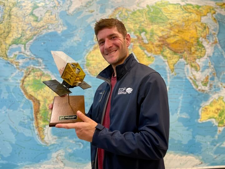
Joshua Benmergui, Ph.D. '19
Living about 500 miles from the North Pole convinced Joshua Benmergui to become an environmental scientist. As an undergraduate student at the University of Waterloo in Canada, Benmergui joined Environment Canada’s high-Arctic research program in Alert, the northernmost continuously inhabited settlement in the world.
“The Dr. Neil Trivett Global Atmosphere Watch Observatory in Alert is one of a number of atmospheric observatories around the world that look at background concentrations of various atmospheric constituents, such as carbon dioxide, methane, mercury and aerosols. The station also monitors the thickness of the ice of lakes in the area, permafrost, and solar radiation,” Benmergui said. “Coming out of the city and into the Arctic and nature, and having the opportunity to think deeply about earth systems, really piqued my interest in a more hands-on way than physics did.”
Benmergui so enjoyed the experience he went back to Alert for a second time before finishing his undergraduate degree in mathematical physics. He obtained a master’s degree in environmental science at Waterloo in 2013, and that fall joined the Harvard John A. Paulson School of Engineering and Applied Sciences (SEAS) as a Ph.D. candidate in environmental science and engineering. He worked in the lab of Steven Wofsy, Abbott Lawrence Rotch Professor of Atmospheric and Environmental Science, helping advance the MethaneSAT satellite project set to launch in 2024.
“Steve had me do a few initial studies on what a satellite like this might be able to see and detect, and how it would flow, and over time it grew into a massive project,” Benmergui said.
MethaneSAT is a collaboration between SEAS and the nonprofit Environmental Defense Fund (EDF). Benmergui is still working on the same project he helped develop a decade ago while earning his Ph.D. and continuing as a postdoctoral researcher and research associate. He was the first person in Wofsy’s lab to transition to the EDF fulltime as a senior science engineer in 2022. (He is still an Associate in Environmental Science and Engineering at SEAS.) Benmergui also works on MethaneAIR, the airborne precursor to the satellite program.
“I have two major responsibilities: mission and target planning, and analytics,” Benmergui said. “I’ve designed a piece of software that creates a very detailed mission plan for MethaneSAT, deciding when to scan which targets. I also wrote a lot of the algorithms and software that look at observed methane concentrations and try to quantify methane emissions.”
MethaneSAT differs from previous methane observation efforts because of its scale. The satellite can scan an image of approximately 200 square kilometers, and from that image recognize both large-scale emissions as well as individual plumes of methane from, for instance, a single oil well.
“It’s incredibly exciting to produce information that can be taken by various stakeholders and be put into action,” Benmergui said. “It can get you the total budget of methane emissions from an oil and gas basin, while also giving you the detail of what emissions are coming from where, and it can go back time and time again to see how it changes and varies. You can see the air moving around and the methane being contributed to the atmosphere, and it gives you a picture of the emissions with a level of detail we could’ve only dreamed of a few years ago.”
Methane plays a major role in short-term global warming, and MethaneSAT’s more accurate data on emissions sources could lead to more impactful climate policy. But that’s just one way to use the data. Oil- and gas-basin producers could use it to identify leaks, which represent potential revenue lost to the atmosphere. Fixing those leaks could save money while simultaneously reducing methane emissions.
“Hopefully it creates a synergy between different kinds of stakeholders,” he said. “A reduction in emissions of this greenhouse gas is both environmentally and commercially beneficial.”
While environmental activists and oil producers are two obvious stakeholders who could benefit from this data, everyone will have free access to it. MethaneSAT is funded through private philanthropy, and the data it produces will be free to the public.
“No matter who you are, you’ll have free access to the data, and all of our algorithms will be publicly accessible,” Benmergui said. “There’s a huge degree of transparency and freedom to it that democratizes the data.”
Benmergui has traveled thousands of miles south from his first exposure to climate science in Alert 15 years ago. But through the work he began as a SEAS student and continues to this day, he’s never lost the passion to understand how the earth works and is affected by human activity.
“I’ve met so many incredible people at Harvard that I don’t think I would’ve had access to in any other place on earth,” he said. “I’ve gotten to be part of this huge project that’s going to make real contributions to society. It’s good to know that the product you’re creating, and the things that you’re doing, is going to be helpful for people.”
Press Contact
Matt Goisman | mgoisman@g.harvard.edu
